Investment Opportunities
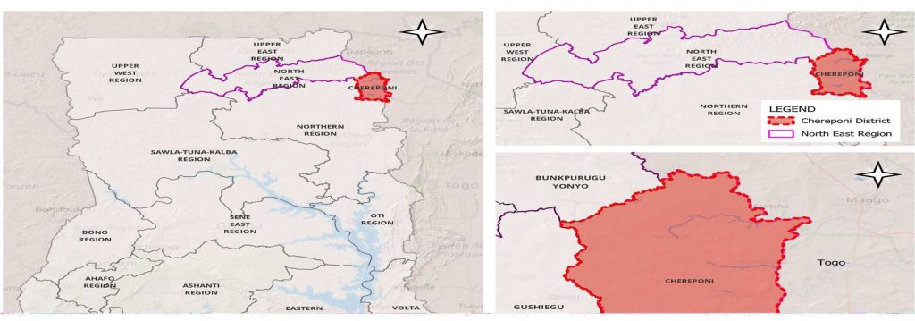
Chereponi District was carved out of what was previously called Saboba-Chereponi District in October 2007 by Legislative Instrument (E.I. 11, 2007). In accordance with law the new District was officially inaugurated in February 2008. Located in the North East Region of the country it shares boundaries with Gushegu District to the West, Saboba District to the South, the Republic of Togo to the East and the River Oti to on the eastern boundary which serves as a very vital resource for agriculture and other related economic activities.
Chereponi district in Summary


Map of CHEREPONI DISTRICT IN THE NORTH EAST REGION of Ghana
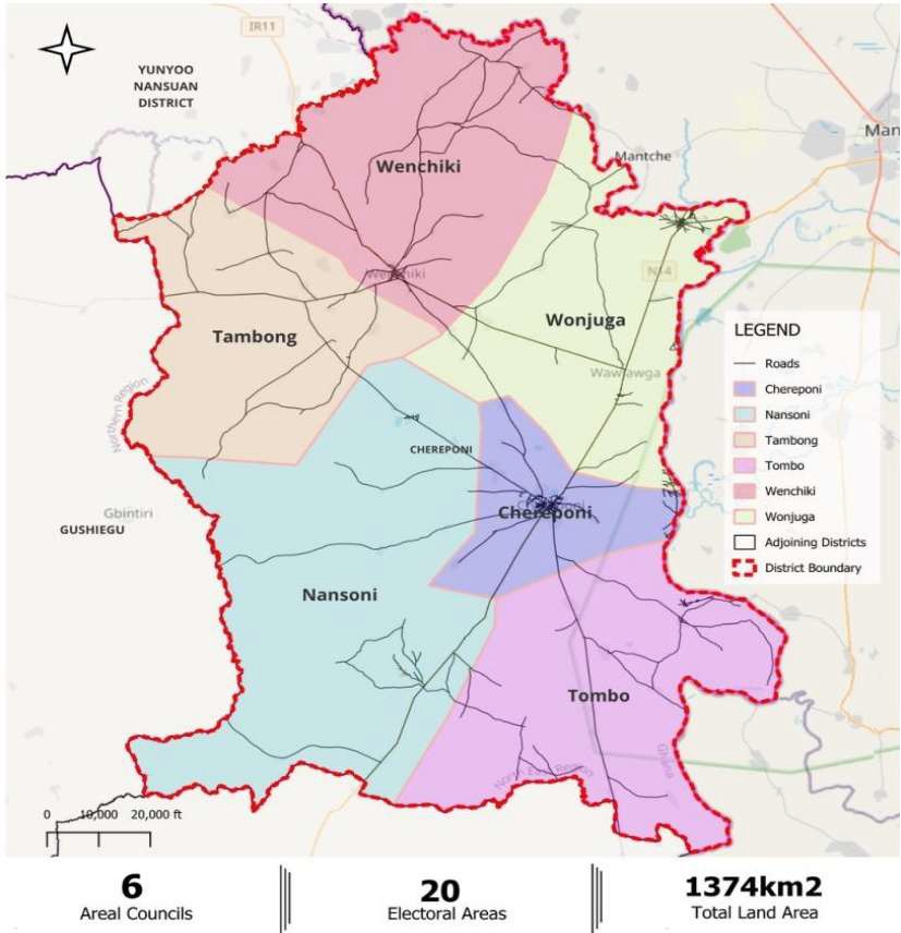
The District has five Area Councils and one Town Council which are shown in the administrative map below, the area and town councils are administrative structures intended to deepen decentralisation and bring local governance closer to the citizenry, they are made of Assembly and Unit Committee members who are usually elected and run by dedicated public servants appointed by the assembly.
ADMINISTRATIVE map OF CHEREPONI DISTRICT